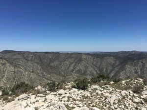
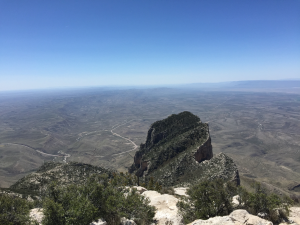
Texas: Guadalupe Peak (8,749 feet)
Distance: 8.4 miles
Elevation gain: 3,000 feet
Time on Trail: 5 hours, including 20 minutes at the summit
Bathrooms: Flushing toilets at Visitor’s Center and at Trailhead (.6 miles from each other)
Date: April 25, 2015
Class 1, Strenuous
Texans are a proud bunch – loyal to their state, their oversized vehicles, and their cowboy culture. The state highpoint is simply another feature that Texans can, and should, tout. Guadalupe Peak is worth the effort of both getting there and climbing it.
Camping appears abundant in Guadalupe National Park. If you’re aiming to spend your pre- or post-climb night close by, this is probably your best option. For those who prefer hotels over camping, El Paso is a convenient choice with only a 2 hour drive between you and the mountain.
Staying in El Paso, you can still easily arrive as the Visitor’s Center opens at 8:00 am. Since you cannot climb without paying the $5/person hiking fee, 8:00 is the earliest possible start for a day visit. You must display the paid receipt on your dash to avoid getting fined or towed. Although I’d planned on being there for 8, we got off to a slow start, ending up on the trailhead at 9:00.
Penalties aside, the rangers at the Visitor’s Center equip you with a map of the hike and answer any last minute questions you may have. I didn’t think I had any, but the questions kept flowing out of my mouth –
- How many false summits are there? Two.
- How long does this hike take most people? Six to eight hours.
- What’s the parking situation at the trailhead? Probably full at this point.
- How fierce is the wind today? Not too bad: gusts up to 50 mph.
- Any surprise afternoon storms expected? None today.
My inquiries continued, but you get the idea. Rangers are a valuable resource and they’re happy to help, so stop in for a chat. After your hike, to celebrate your successful summit, return to browse the store. The Visitor’s Center carries a few souvenirs and has a National Parks stamp near the entrance.
Parking by the trailhead is limited for regular sized cars and routinely fills up on weekends by 9:00 am. A few random spots are on the side of the road in between the trailhead and Visitor’s Center, so pay attention to those on your way to scope out the trailhead situation. If you drive an RV, you may have a better shot arriving later in the day as those spots were in abundance. Worst case, you’ll be relegated to the Visitor’s Center parking lot, adding an extra 1.2 miles to your day.
Bathroom needs can be met at the Visitor’s Center and at the trailhead. Live large. Try both for good measure. And, be sure you start with those needs met because the trail is narrow with little, if any, privacy along the way.
Guadalupe Peak gains 3000 feet in elevation over the course of 4.2 miles one way. A few, brief sections of the trail are relatively flat. Otherwise, brace for a near constant steep, rocky climb. Even with hiking poles, proper footwear, and taped ankles, rolling ankles is a huge risk. So, watch your footing.
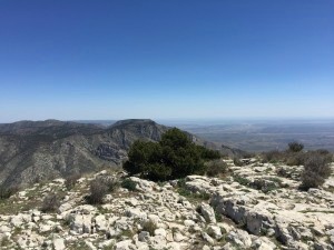
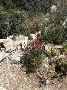
The benefit of a steep trail is that you almost immediately begin to reap the rewards of good views. After just 20 minutes, we seemed to tower above the now matchbox sized cars in the lot. Equally rewarding are the beautiful cacti and random flowers that sprout from rocks along the trail. Bursts of unexpected reds or yellows in this desert environment make for a nice treat.
April is evidently notorious for high winds on Guadalupe. After false summit #1, we crossed over a ridge and felt the full force of those 50 mph winds. I had to hold on to my hat often. Two or three times, we stopped moving until the gust had passed. On one particularly strong gust, I got smacked in the face with my temporarily unclipped chest strap. That didn’t exactly tickle. Needless to say, I didn’t make that mistake again.
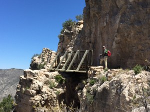
After more switchbacks and elevation gain comes the wooden bridge landmark with some pretty steep drop offs that wouldn’t end well if someone lost their footing. The trail is narrow, but still easily sharable. From the bridge, it’s about another 40 minutes to the summit. I offer this as a guidepost since while you’re hiking this trail, it’s hard to tell how much distance remains and even which peak you’re headed to. Similarly, the trail does not contain mileage markers along the way. After the bridge, it’s another series of switchbacks in an area of high exposure.
Interested in the waterproof pack my husband is sporting on the bridge? Read about it here.
Rounding the final curve, you are rewarded with a glistening metal pyramid that shines like a beacon welcoming you to the summit after a steady two and a half hour climb battling fierce winds. The three-sided pyramid pays tribute to Butterfield Overland Mail, the 1857 to 1861 stagecoach that carried mail between San Francisco and Memphis or St. Louis. Be sure to sign the register (by the base of the pyramid). The summit is a great place to have a snack or lunch and enjoy the fantastic views.
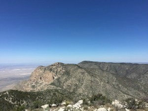
Be sure to check out the view of El Capitan, 665 feet lower than Guadalupe Peak.
After a rewarding summit comes the hard part: the descent. This is one punishing descent on the knees. With all of the rocks, including some loose scree, each step requires focus. To put the terrain in context, our trip down was only 15 minutes quicker than the trip up. Still, with great exercise and even better views – Texas has earned a place in my heart with this one.
Special thanks to Toby, originally from El Paso, for his Hueco Tanks recommendation! Located in between El Paso 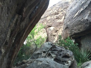 and Guadalupe Peak, this is absolutely worth the stop. Rock climbers from around the world come here as a sort of pilgrimage. Even if you’re not into rock climbing, playing on these rocks will make you feel like a kid, with pure happy abandon. You can explore caves, search for pictographs, hike, and climb. Your $7 admission grants you a full year of access to the State Park. This is a MUST stop.
If you have extra time, White Sands National Monument has several trails of peaceful, other-worldly hiking on the dunes. Be sure to collect the two stamps in the Visitor’s Center for your National Parks passport.

